Home » Your Groups » General Off Topic » Waze App or Google

Waze App or Google

UrbanFox

By UrbanFox, 1726417325

I have the Waze app, it beeps at me when there is an issue up ahead (eg a pothole) or fixed speed camera etc.

I have it set to show the speed limit and the threshold is set at the limit, it will flash a bit at me if I creep over the limit, but doesn't seem to want to make a noise... As far as I can see I have all the sounds/alerts/notification settings on (and it does do an alert as above), but doesn't do anything sound-wise if I go over the limit.

Am I doing something wrong?

Is the Google App better?

Android phone.

Thanks, Tim


JME Studios said, 1726428617

I've tried both and prefer Waze significantly. It won't make a noise if you go over the limit but will give you a visual notification.

waist.it said, 1726439090

Personally I'm not keen on either. They are both owned by Google and carry significant privacy concerns. I prefer OSMAND+. This is free, open source and based on OpenStreetMap mapping. It has no Google tracking, all maps stored locally, off-line. Incredibly feature rich with user configurable feature sets for various usage types (walking,  driving, cycling, sailing, horse-riding etc.) It has a very active development team, with new features being developed and tested on an on going basis. 

And, a little-known fact: if you use the F-Droid version, codenamed "OSMAND~" (rather than the version on Google Play), then all the maps and updates are free too - as many as you can fit on your phone. Out of curiosity, I downloaded the entire planet's maps, including shipping, contours etc. Been updating them all, every month for the last five years. Hasn't cost a me penny. Well, OK, I had to buy a bigger µSD card for my phone a couple of years back... :-)
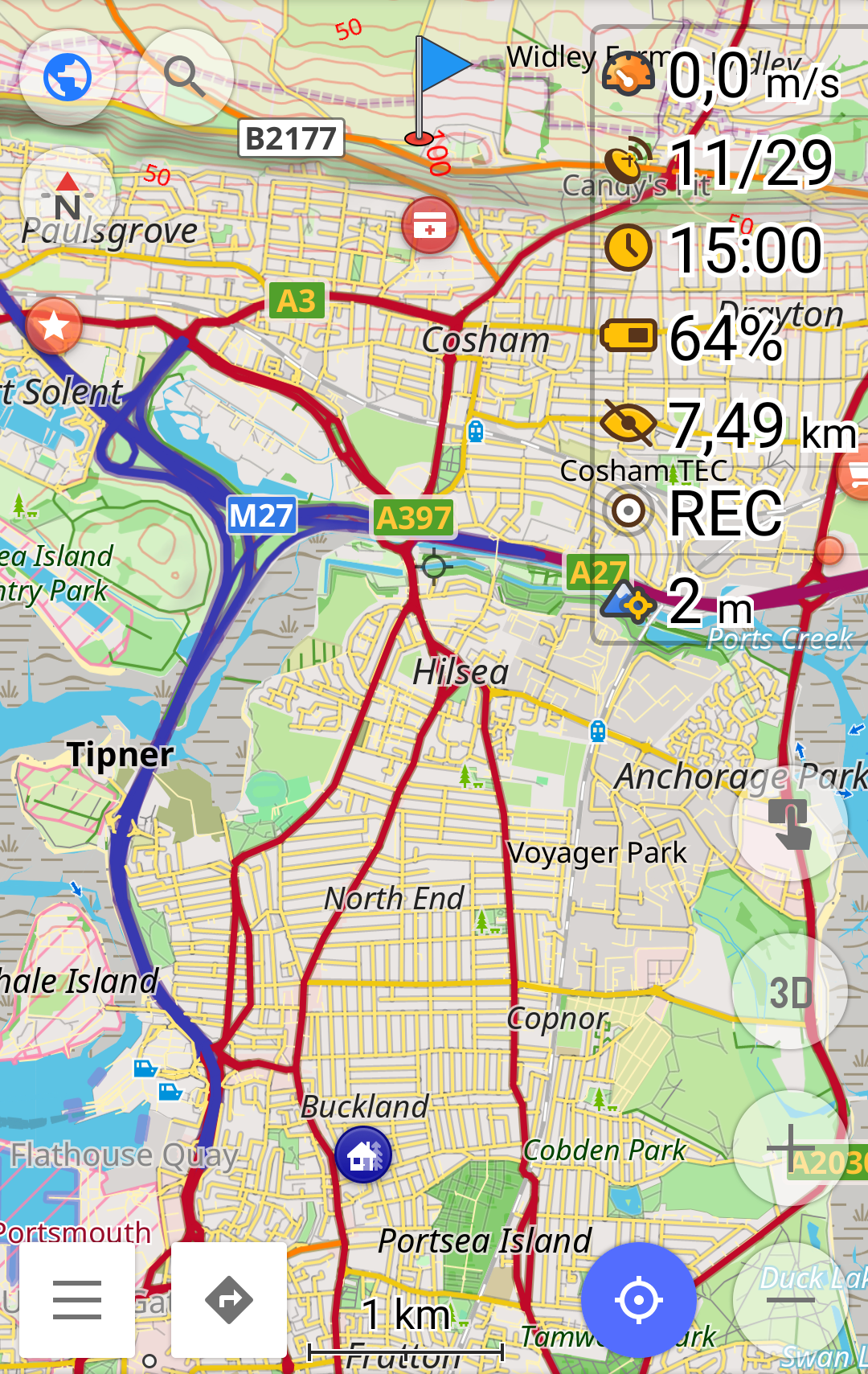


[click map to enlarge]

In answer to the O/P's question, yes OSMAND~ can warn you audibly if you exceed speed limit, if you wish it to do so. And you can set the threshold above which it does so...


Edited by waist.it

JME Studios said, 1726444334

waist.it is there Android Auto support? I've just bought a car with this feature and it's an absolute game changer.

The main deal breaker for me though is live traffic updates. This is something Waze does exceptionally well.

Should add I've nothing to hide and glamour photography notwithstanding I lead an extremely boring life. I turn 40 this week, I live alone, and am single, unmarried and childless. I'm not doing anything I wouldn't want Google to know about.

Edited by JME Studios

waist.it said, 1726446527

JME Studios said

waist.it is there Android Auto support? I've just bought a car with this feature and it's an absolute game changer.

The main deal breaker for me though is live traffic updates. This is something Waze does exceptionally well.

Should add I've nothing to hide and glamour photography notwithstanding I lead an extremely boring life. I turn 40 this week, I live alone, and am single, unmarried and childless. I'm not doing anything I wouldn't want Google to know about.

Edited by JME Studios

Yes it does, but only on the Google Playstore version.

The F-Droid version (with all the free maps) does not support it. Personally I'd rather have all the maps for free and a total divorce from Google. Indeed, it is the freedom from Google that attracts most users to this product. Well that, and the excellent mapping system. But I guess we all have different priorities.

Stu H said, 1726462873

waist.it

As its divorced from Google, how does it handle route updates caused by traffic issues?

Are you able to plot your own route, and follow that, or just have to use its own suggestion?

waist.it said, 1726485665

Stu H said

waist.it

As its divorced from Google, how does it handle route updates caused by traffic issues?

Are you able to plot your own route, and follow that, or just have to use its own suggestion?

It's an off-line mapping system, using detailed vector maps already downloaded stored on your device, that interacts directly with your device's GPS/GLONASS/BeiDou satellite receiver navigation system...

  1. It's updated monthly with no further internet connection required (though you can if you wish for specialist map over/underlays and intermediate updates). So planned works and speed limits will show. Incidents that have just happened will not. There are optional intermediate updates. For example London map will update daily if you wish, via whatever internet connection you have available at the time. But again it will not show incidents that have just happened.
  2. When you go off-route by more than a couple of hundred metres, it automatically recalculates another route. I recently tested its ability to do this by deploying the old trick of setting a long journey, travelling by a vehicle that could not use the motorway, i.e. a bicycle. I then made the journey on the motorway. It tried to get me off the motorway and recalculated for each and every junction, and typically did so within 200 metres. Remembering of course that if you are travelling at the national speed limit, you'll cover 100 metres every three seconds or so (~31 m/s)

JME Studios said, 1726489430

Ah, now you see the live updates are a deal breaker for me.